- Title
- Wetlands of Thessaly Region, Greece
- Abstract
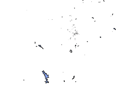
The geospatial dataset contains data about Thessaly region. It has been produced by Region of Thessaly (BIOSFERA contractor). Wetland detection was based on existing EKBY wetland archives and on results of water surface dynamics mapping via Sentinel2 sattelite imagery (spatial resolution 10 meters) of the year 2017, produced in collaboration with the National Observatory of Athens. The delineation of final wetland polygons was performed by computer-based photo interpretation using Google's (hybrid) cartographic background.. Field verification (2018) has been performed for the sites outside NATURA 2000 sites. Inventory data on habitats, fauna, flora, condition, activities and impacts, ecosystem services are stored per wetland site.
- License
- Not Specified
-
+ The original author did not specify a license.
- Publication Date
- May 8, 2020, 2:36 a.m.
- Type
- Vector Data
- Keywords
- Greece Thessaly Wetlands
- Category
- Environment
- environmental resources, protection and conservation. Examples: environmental pollution, waste storage and treatment, environmental impact assessment, monitoring environmental risk, nature reserves, landscape
- Regions
- Europe, Greece
- Approved
- Yes
- Published
- Yes
- Featured
- No
- Name
- EKBY
- Position
- Project partner 2
- Organization
- Greek Biotope-Wetland Centre
- Location
- Voice
- Fax
- Identification Image
-
- Spatial Extent
- ---
- Projection System
- EPSG:3035
- Extension x0
- 5277217.055900000000000
- Extension x1
- 5471015.521100000000000
- Extension y0
- 1862842.756600000000000
- Extension y1
- 1969616.357700000000000
- Maintenance Frequency
- Frequency Of Maintenance For The Data Is Not Known
- Restrictions
- No conditions apply for access. For use: You are free to share, copy and redistribute the material in any medium or format under the following terms: a) give appropriate credit using the reference: "Greek Biotope - Wetland Centre and Thessaly Region. 2019. Geospatial dataset: Wetlands of Thessaly Region, Greece. WetMainAreas INTERREG BalkanMed project"; b) non commerical; c) no derivatives; d) no additional restrictions. For more details please refer to the Creative Commons Attribution 4.0 International license (CC BY-SA 4.0) https://creativecommons.org/licenses/by-nc-nd/4.0/.
- Language
- English
- Data Quality
- Responsible organization is the Greek Biotope/Wetland Centre (EKBY) and the Thessaly Region.
- Supplemental Information
No information provided
- Spatial Representation Type
- vector data is used to represent geographic data
- Name
- EKBY
- Position
- Project partner 2
- Organization
- Greek Biotope-Wetland Centre
- Location
- Voice
- Fax
- Link Online
- /layers/geonode:gr_wetlands_thessaly
- Metadata Page
- /layers/geonode:gr_wetlands_thessaly/metadata_detail
- Tiles
- Wetlands of Thessaly Region, Greece.tiles
- Legend
- Wetlands of Thessaly Region, Greece.png
- Thumbnail
- Wetlands of Thessaly Region, Greece.png
- Remote Thumbnail
- Wetlands of Thessaly Region, Greece.png
- View in Google Earth
- Wetlands of Thessaly Region, Greece.kml
- KML
- Wetlands of Thessaly Region, Greece.kml
- GeoJSON
- Wetlands of Thessaly Region, Greece.json
- Excel
- Wetlands of Thessaly Region, Greece.excel
- CSV
- Wetlands of Thessaly Region, Greece.csv
- GML 3.1.1
- Wetlands of Thessaly Region, Greece.gml
- GML 2.0
- Wetlands of Thessaly Region, Greece.gml
- Zipped Shapefile
- Wetlands of Thessaly Region, Greece.zip
- PNG
- Wetlands of Thessaly Region, Greece.png
- Wetlands of Thessaly Region, Greece.pdf
- JPEG
- Wetlands of Thessaly Region, Greece.jpg
- OGC WFS: geonode Service
- Geoservice OGC:WFS
- OGC WMS: geonode Service
- Geoservice OGC:WMS
- Name
- EKBY
- Position
- Project partner 2
- Organization
- Greek Biotope-Wetland Centre
- Location
- Voice
- Fax